Friday, February 14, 2014

Friday, February 14. 2014


Happy Valentines Day Family
Today's schedule is A-AG-B-C-D


A Block Social Studies 11 - Today we'll have the block to work on the bill into law comic / cartoon that we started yesterday. Don't forget to use the Make it Law sheet we used to form ideas yesterday and the legislative process steps I outlined with you in class. If you need help look in your Counterpoints textbook and the Parliament of Canada "Follow That Bill" website.


B Block Geography 12 - Today we'll finish our work on the Prince Rupert topographic map from the Canadian Landscape (pages 20 - 23). We finished question 1 yesterday and you'll have time today to work on the rest of the assignment that will be due tomorrow (questions 2, 3, 4 a & b, 5, 7 a,b,d & e, and 9 a & b). Use Google Earth or Google Maps to help you with this assignment and don't forget here are a few webpages to help:
Natural Resources Canada Toporama
Reading Topographic Maps
United States Geological Survey Reading Topo Maps
Idaho State University Interpreting Topo Maps
Natural Resources & Water Queensland Australia Interpreting Topo Maps pdf

I will also be collecting your Week 2 packages in class to mark today.

D Block Social Studies 10 - Today you are going to continue your work on the Summerland topographic map (82E/12). The questions you need to work on are 2 (a&b), 3 (c&d), 4, 5 (a-e), 6, 7, 8 (a-c, omit d, e-g) on pages 50-52 of the Geographic Understandings text. Remember For questions 5 & 8 consider the following agribusinesses in Summerland:
Dirty Laundry Vineyards
Sumac Ridge Estate Winery
Sonoran Estate Winery

Wednesday, February 12, 2014

Thursday, February 13. 2014

The schedule for today is D-AG-C-B-A

D Block Social Studies 10 - OK so yesterday we started working on encoding data on to two maps (question 2 from page 21 of the Geographic Understandings textbook). Today I'll have coloured pencils in the class for you to continue and finish this assignment. After, you are going to begin work on the Summerland topographic map (82E/12). The questions you need to work on are 2 (a&b), 3 (c&d), 4, 5 (a-e), 6, 7, 8 (a-c, omit d, e-g) on pages 50-52 of the Geographic Understandings text.

Look to the left, it's the 4th edition map from 2008 and the one in your text is the 2nd edition...what differences are there? We'll look at Summerland on Google Maps because you can see a satellite (Google Earth) view and a terrain view which has the topographic contours on it. For questions 5 & 8 consider the following agribusinesses in Summerland:
Dirty Laundry Vineyards
Sumac Ridge Estate Winery
Sonoran Estate Winery

Here are a few webpages to help:
Natural Resources Canada Toporama
Reading Topographic Maps
Mount Union College Reading Topo Maps
United States Geological Survey Reading Topo Maps
Idaho State University Interpreting Topo Maps
National Wildfire Coordinating Group Reading Topographic maps pdf
Natural Resources & Water Queensland Australia Interpreting Topo Maps pdf
How Stuff Works Reading a Topographic Map
How to Read Topographical Maps

B Block Geography 12 - Today we'll finish our introduction to topographic maps that we started on Friday and then we'll work on the Prince Rupert topographic map from the Canadian Landscape (pages 20 - 23 & click on the map below). I'll need you to work on questions 1, 2, 3, 4 a & b, 5, 7 a,b,d & e, and 9 a & b. Use Google Earth or Google Maps to help you with this assignment and if you have a problem or question you should post a comment on this blog entry or e-mail me at my school address.

You'll have tomorrow's class to work through this assignment as well.

A Block Social Studies 11 - OK so yesterday we had fun taking a look at the legislative branch of the federal government system. Remember the job of the legislative branch is to legislate - to create or repeal/change laws in Canada. To demonstrate your fabulous new knowledge you will have to draft a simplified bill that you would like to see made law, where you'll write the idea in a simple sentence or two and then use the Make It Law handout to organize your ideas (you'll get it in class this morning). After this, you'll create a comic strip demonstrating the process of how a Bill becomes a Law in Canada using the legislative process steps I'll outline with you in class. If you need help look in your Counterpoints textbook and the Parliament of Canada "Follow That Bill" website. You'll have more time tomorrow to work on this assignment and it will be due on Tuesday when you return after your long weekend.

Wednesday, February 12. 2014

Today's schedule is B-AG-A-D-C (please note blocks are shortened for an extended AG - Grades 8-11 for programming and grade 12 for graduation)

B Block Geography 12 - 
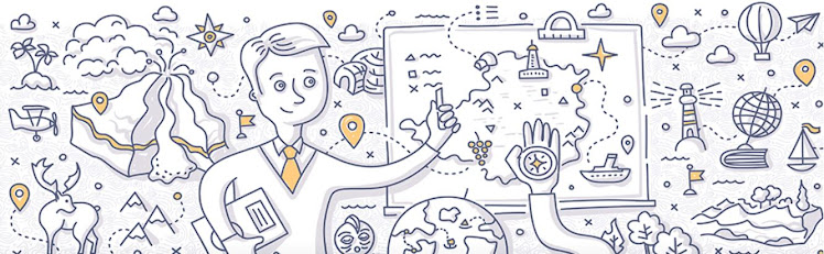
Today we'll do a brief introduction to topographic maps and I'll show you how to identify location, estimate area, calculate slope, and determine direction on them. We'll look at large versions of the 1:50000 scale topographic maps for the Comox Valley (92F10 and 92F11). For a large copy of the Forbidden Plateau 92F11 map click on the Online - En ligne (PDF or TIFF) at the GEOSCAN Fast-Link site. Using these maps we'll try to make sense of topographic maps in partners.

Here are a few webpages to help:
Natural Resources Canada Toporama
Reading Topographic Maps
Mount Union College Reading Topo Maps
United States Geological Survey Reading Topo Maps
Idaho State University Interpreting Topo Maps
National Wildfire Coordinating Group Reading Topographic maps pdf
Natural Resources & Water Queensland Australia Interpreting Topo Maps pdf
How Stuff Works Reading a Topographic Map
How to Read Topographical Maps

A Block Social Studies 11 - Today we'll continue looking at the "legislative process" - creating laws in Canada.

An idea to make a new law or to change an existing law starts out as a "bill." Each bill goes through several stages to become law.
  1. At first reading, the bill is considered read for the first time and is printed. There is no debate.
  2. At second reading, Members debate the principle of a bill — is the idea behind it sound? Does it meet people's needs?
  3. If a bill passes at second reading, it goes to a committee of the House. Committee members study the bill carefully. They hold hearings to gather information. They can ask for government officials and experts to come and answer questions. The committee can propose amendments, or changes, to the bill. When a committee has finished its study, it reports the bill back to the House. The entire House can then debate it. During report stage debate, Members can suggest other amendments to the bill.
  4. Once report stage is over, the bill is called for third reading debate. Members who voted for the bill at second reading may sometimes change their minds at third reading after seeing what amendments have or have not been made to the bill.
  5. After a bill has passed third reading in the House of Commons, it goes through a similar process in the Senate.
  6. Once both Chambers pass the bill in the same form, it is given Royal Assent and becomes law.
You will have to draft a simplified bill that you would like to see made law, where you'll write the idea in a simple sentence or two and then use the Make It Law handout to organize your ideas. After this, you'll create a comic strip demonstrating the process of how a Bill becomes a Law in Canada for next Tuesday.

D Block Social Studies 10 -  Today we'll continue with our work in the Geographic Understandings book (they're the green geography books in the class). Today I'd like to work on map symbols, relief and contours. You'll need to work through the following:

1. Page 20 questions 1, 2, and 3

After this, I'm going to ask you to draw two maps for me, so you'll need to work through questions 1 and 2 from page 21. Read the descriptions and then draw both maps...

The Natural Resources Canada website Toporama is a great resource to understand topographic map basics. Check out their Tips and Hints site here. There is a good tutorial on building topographic profiles on the Idaho State University Department of Geosciences website here. There's also a great tutorial here as well. Topographic Map symbols can be found here.

Monday, February 10, 2014

Tuesday, February 11. 2014

Today's schedule is C-AG-D-A-B

D Block Social Studies 10 - Today we'll continue looking at how to read a map focusing on direction, scale, and distance. First you can start with finishing Friday's questions 2,3,4 & 5a on page 3 & 4 as well as questions 1-4 on page 7 of the Geographic Understandings book.

For direction you'll need to work on questions 1-4 on pages 8 & 9 and for scale & distance you'll need to work on question 4 on page 17 and question 1 on page 18.

Take a look at the following websites for help with time zones:
Time for Time
Time and Date
From Stargazers to Starships
NOVA: The Search for Longitude

Royal Astronomical Society Calgary: Latitude and Longitude
US National Atlas - Latitude and Longitude

A Block Social Studies 11 -  Today we'll look at the Legislative Branch of the Federal government in Canada starting with the House of Commons. You'll need to work on three questions:
  1. What is "Caucus" and what does it do?
  2. What is "Cabinet", what is "Cabinet Solidarity", what happens when you break "cabinet solidarity", how do you get to be a cabinet member, and identify three ministries covered in the federal cabinet?
  3. What is the "Official Opposition" and what do they do?

Here are some websites to help:
Current Canadian Ministry (Cabinet)
Privy Council Office: About Cabinet
NDP Official Opposition Shadow Cabinet
Parliament Of Canada Members of the Cabinet and Opposition Critics

B Block Geography 12 - Today we'll finish our look at spheres in geography. Next, we'll work on time zones, latitude and longitude, GPS, and the remote sensing technology of GIS (We'll watch a Brainpop video on GPS with Tim & Moby). There are five questions in the week one handout to have completed for today's class. Your homework this past weekend was to look at figure 1.8 (p.13) and figure 1.9 (p.14) in the Geosystems book and try to interpret the relationships amongst the four spheres as a result of humans burning fossil fuels. If you're having trouble with this consider the carbon cycle (pages 634-5 in text) or look the links on yesterday's blog entry for more help.
For more on GIS check out:
USGS GIS Poster
ESRI What can I do with GIS?